Vancouver, British Columbia--(Newsfile Corp. - November 10, 2026) - Excalibur Metals Corp. (TSXV: EXCL) (OTCQB: EXCBF) ("Excalibur" or the "Company") is pleased to announce that it has engaged Precision GeoSurveys US Inc. ("Precision") to conduct a high-resolution helicopter-borne magnetic and radiometric survey at the Company's Bellehelen Silver-Gold Project ("Bellehelen" or the "Project") in Nye County, Nevada. The planned 876 line-kilometre survey will cover approximately 79.6 square kilometres and build on airborne data collected by Precision in 2020 to support geological interpretation and exploration target development.
Program Highlights
- Experienced survey contractor: Precision has acquired and processed data from more than 800 airborne geophysical surveys since 2007, including the 2020 Bellehelen survey.
- Detailed survey coverage: Approximately 876 line-kilometres at 100-metre survey-line spacing, with 1,000-metre tie-line spacing and a nominal terrain clearance of 30 metres above ground level.
- Closer spacing in overlapping areas: New survey lines will be offset by 50 metres from the 2020 lines, providing effective 50-metre spacing where the two surveys overlap.
- Integrated target development: Magnetic and radiometric data will complement geological mapping, geochemistry and existing geophysical datasets to help refine exploration targets.
"Precision's experience at Bellehelen provides continuity as we build on the existing airborne dataset," commented John Gilbert, CEO of Excalibur. "The closer line spacing in areas of overlap will give us a more detailed view of geological structures that may influence the distribution of silver-gold mineralization. There remain large geophysical anomalies that continue beyond our existing dataset along the main Bellehelen trend and are associated with silver and gold mineralization. Our understanding of the system at Bellehelen continues to grow, as does the system's size. Integrating this information with our mapping, sampling and ground geophysics will help us refine targets and prioritize areas for future drill testing."
Bellehelen Airborne Survey
The program comprises approximately 795 line-kilometres of survey lines and 81 line-kilometres of perpendicular tie lines. Precision will use the same survey reference point, technologies and specifications as its 2020 survey to facilitate merging the new and historical magnetic and radiometric datasets.
Magnetic surveying measures variations in the Earth's magnetic field associated with differences in the magnetic properties of rocks. The data can help interpret rock units, geological contacts and structures, including features beneath cover. Radiometric surveying measures natural gamma radiation from near-surface materials and can help distinguish rock types and identify patterns potentially associated with alteration. These methods support geological interpretation but do not directly establish the presence, grade or continuity of silver-gold mineralization.
To view an enhanced version of this graphic, please visit:
https://images.newsfilecorp.com/files/11871/323295_6011111244f1b908_001full.jpg
The new dataset is intended to complement the Company's broader exploration work at Bellehelen, including the recently reported gravity survey at Rangefront (see Excalibur news release dated October 20th, 2026), previous controlled-source audio-frequency magnetotelluric ("CSAMT") surveying, geological mapping and surface geochemical sampling. Integrated interpretation will help the Company assess structural relationships and refine priorities for further exploration.
Survey Equipment and Schedule
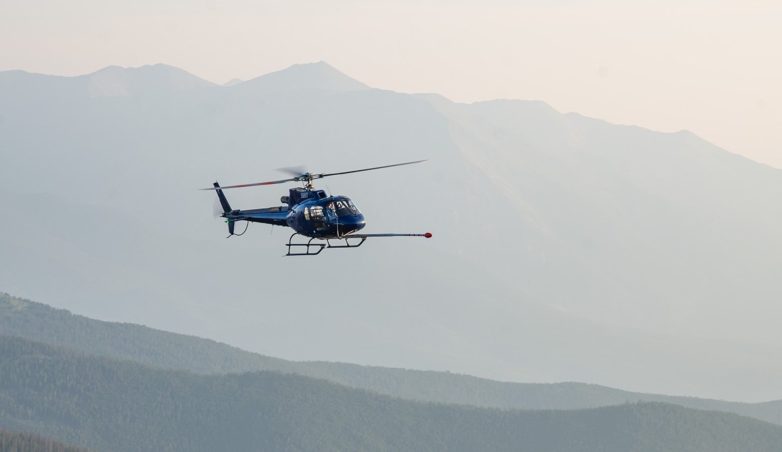
Precision's planned helicopter-mounted system at Bellehelen includes a magnetic sensor installed in a non-magnetic nose boom and gamma detection crystals mounted inside the aircraft. This configuration supports low-level, terrain-following surveying without a suspended sensor system. Real-time three-axis magnetic compensation is used to reduce aircraft-related magnetic effects.
Magnetic measurements will be collected at 20 samples per second, providing approximately one- to two-metre sample intervals along flight lines. Radiometric measurements will be collected once per second. Precision will undertake daily preliminary quality control, followed by final processing and delivery of merged datasets, maps and a survey logistics report.
Mobilization is anticipated in mid-November 2026, subject to weather, aircraft and equipment availability, permitting, airspace restrictions and other operational considerations. Final processed data and maps are expected approximately three to four weeks after field operations are completed, subject to data quality and processing requirements.
About Precision GeoSurveys
Precision GeoSurveys specializes in airborne geophysical surveying in mountainous and remote terrain and has completed more than 800 high-resolution surveys worldwide. Its experience spans Canada and the United States, including Nevada, as well as projects in Asia, Africa and Europe. Precision's President, Harmen J. Keyser, P.Geo., is a geologist and helicopter pilot with more than 40 years of experience in mineral exploration and helicopter operations and over 12,000 hours of flight time, primarily in exploration and geophysical applications. Precision's team brings expertise in survey design, data acquisition, processing and interpretation across a range of geological environments and mineral deposit types.
Qualified Person
Matthew Dumala, P.Eng., an independent consultant of the Company, is a Qualified Person ("QP") as defined by National Instrument 43-101. Mr. Dumala has reviewed and approved the technical information disclosed in this news release.
About Bellehelen
Bellehelen encompasses a district-scale, 10-kilometre-long mineralized trend that historically produced an estimated 311,000 silver-equivalent ounces in the early 1900s1. Numerous historic workings are distributed along the entire length of this extensive corridor, highlighting a continuity of mineralization across multiple zones on the Property. Historical surface sampling returned high-grade assays of up to 11.25 g/t gold and 3,490 g/t silver1, confirming the presence of a fertile precious metal system. Broad soil anomalies, extensive vein networks and the results of the Company's recent drilling and geophysical programs demonstrate the potential for both structurally controlled higher-grade mineralization and broader zones of disseminated mineralization.
About Excalibur Metals Corp.
Excalibur Metals Corp. is focused on exploring for precious metals within established mining areas in the Western United States. The Company has acquired the option to purchase 100% of the Bellehelen Project in Nye County, Central Nevada. The claims cover most of the historic Bellehelen Mining District, where gold and silver were initially discovered and mined in the early 1900s. Excalibur has assembled an exceptional team with considerable exploration, development and permitting experience within North America. Excalibur is traded on the TSX Venture Exchange (TSXV) under the symbol "EXCL" and on the OTCQB Venture Market under the symbol "EXCBF". For more information, visit www.excaliburmetals.com.
EXCALIBUR METALS CORP.
On behalf of the Company
"John Gilbert"
CEO
For further information regarding this news release, please contact:
John Gilbert, CEO
Evelyn Cox
604-687-3376
info@excaliburmetals.com
Notes
1 Details about the historical production and results at Bellehelen can be found in the technical report titled "Bellehelen Property NI 43-101 Technical Report" authored by Heather Burrell, B.Sc., P.Geo. with an effective date of August 15, 2024 filed on SEDAR+ and referenced from Kleinhampl F.J. & J.I. Ziony. 1984a. Geology of Northern Nye County, NV. Nevada Bureau of Mines & Geology Bulletin 99A.
Cautionary Note Regarding Forward-Looking Information
This news release contains "forward-looking information" concerning anticipated developments and events that may occur in the future. Forward looking information contained in this news release includes, but is not limited to, statements regarding the scope, coverage, line spacing, equipment, timing of mobilization, fieldwork and delivery of processed data of the airborne magnetic and radiometric survey; the integration of new and historical datasets; the anticipated benefits of the survey for geological interpretation and target development; and the identification and prioritization of areas for further exploration and potential drill testing at Bellehelen.
In certain cases, forward-looking information can be identified by the use of words such as "plans", "expects" or "does not expect", "budget", "scheduled", "estimates", "forecasts", "intends", "anticipates" or "does not anticipate", or "believes", or variations of such words and phrases or state that certain actions, events or results "may", "could", "would", "might", "occur" or "be achieved" suggesting future outcomes, or other expectations, beliefs, plans, objectives, assumptions, intentions or statements about future events or performance. Forward-looking information contained in this news release is based on certain factors and assumptions regarding, among other things, the availability of financing to continue as a going concern and implement the Company's operational plans, metal prices, the timing and amount of future exploration expenditures, the availability of labour, equipment and material, receipt of and compliance with necessary regulatory approvals and permits, the estimation of insurance coverage, and assumptions with respect to currency fluctuations, environmental risks, title disputes or claims, and other similar matters. While the Company considers these assumptions to be reasonable based on information currently available to it, they may prove to be incorrect.
Forward looking information involves known and unknown risks, uncertainties and other factors which may cause the actual results, performance or achievements of the Company to be materially different from any future results, performance or achievements expressed or implied by the forward-looking information. Such factors include risks related to the Company not obtaining adequate financing to continue operations, risks related to the delay in approval of work plans, risks that geophysical survey interpretations may not accurately reflect subsurface geology or that drill testing may not confirm geophysical interpretations, variations in mineral resources and reserves, grade or recovery rates, risks relating to the ability to access infrastructure, risks relating to changes in commodity prices, risks related to current global financial conditions on the Company's business, access and supply risks, reliance on key personnel, operational risks inherent in the conduct of exploration activities, including the risk of accidents, labour disputes, regulatory risks including the risk that permits may not be obtained in a timely fashion or at all, financing, capitalization and liquidity risks, risks related to disputes concerning property titles and interests, environmental risks and the additional risks identified in the "Risk Factors" section of the Company's reports and filings with applicable Canadian securities regulators.
Although the Company has attempted to identify important factors that could cause actual actions, events or results to differ materially from those described in forward-looking information, there may be other factors that cause actions, events or results not to be as anticipated, estimated or intended. Accordingly, readers should not place undue reliance on forward-looking information. The forward-looking information is made as of the date of this news release. Except as required by applicable securities laws, the Company does not undertake any obligation to publicly update or revise any forward-looking information.
Neither the TSX Venture Exchange nor its Regulation Services Provider (as that term is defined in the policies of the TSX Venture Exchange) has reviewed or accepts responsibility for the adequacy or accuracy of this release.

To view the source version of this press release, please visit https://www.newsfilecorp.com/release/323295